デジタル技術を用いた「ウェブ版洪水・土砂災害ハザードマップ」の開発
Development of “the flood disaster hazard map for Web”
著者
論文を見る→J-STAGE(購読者認証が必要です)
抄録
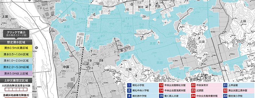
全国で甚大な水災害が発生している一方、岡山県は「気象災害が少ない土地」というイメージが定着していることから、県民の減災意識が希薄である。日常時の減災意識の低さが実際に避難を必要とするような気象災害に直面した時の岡山県民の行動に影響することは言うまでもない。
本研究は、平常時に使用することで減災意識を高めることのできるツールとしてのハザードマップに注目し、従来の印刷物によるハザードマップの現状においてアンケート調査を中心に問題点を抽出し、インタラクティブ技術やAR技術によって可視化すべき情報を明らかにし、「ウェブ版 洪水・土砂災害ハザードマップ」へ改良するものである。
Being ready for an emergency can make a significance difference on the outcome of a crisis. Since flood damage occurs almost every year in Japan, residents need to prepare by acquiring accurate knowledge and developing an interest in disaster prevention. The flood hazard map has been developed and is currently used in daily life.
In this study, we first carried out questionary survey in order to extract problems for The existing flood hazard map.
This study, based on the identified shortcomings of previous hazard maps, proposes a new map by the website whose effectiveness is demonstrated through practical experiments.

